Under the cloak of the night sky we were completely lost, clinging to the side of a mountain cliff with no ropes or harnesses, shivering cold in below freezing temperatures, and unable to breath the thin air. Surely we had to be close to the mountain’s summit but the moonlight wasn’t bright enough to tell. Maybe we should play it safe and just head back down the way we came, but climbing down at this point seemed even more challenging than continuing upward. This is what our Sunday morning has become. It was 5:30 AM and we were gasping for air, hanging on the edge of the highest mountain in Central America: Volcan Tajumulco. The following recants our harrowing tale during our Volcan Tajumulco hike in Guatemala.
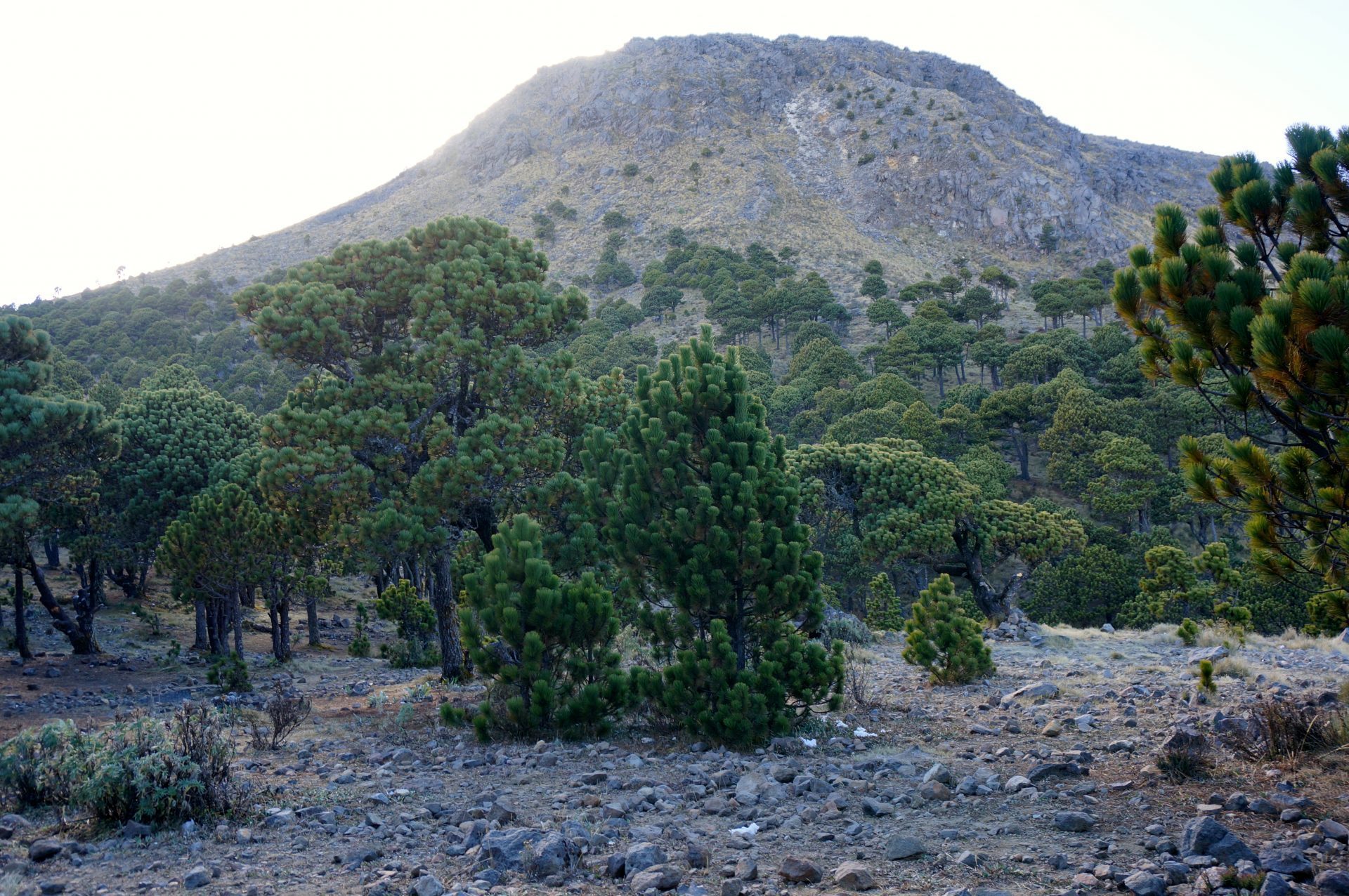
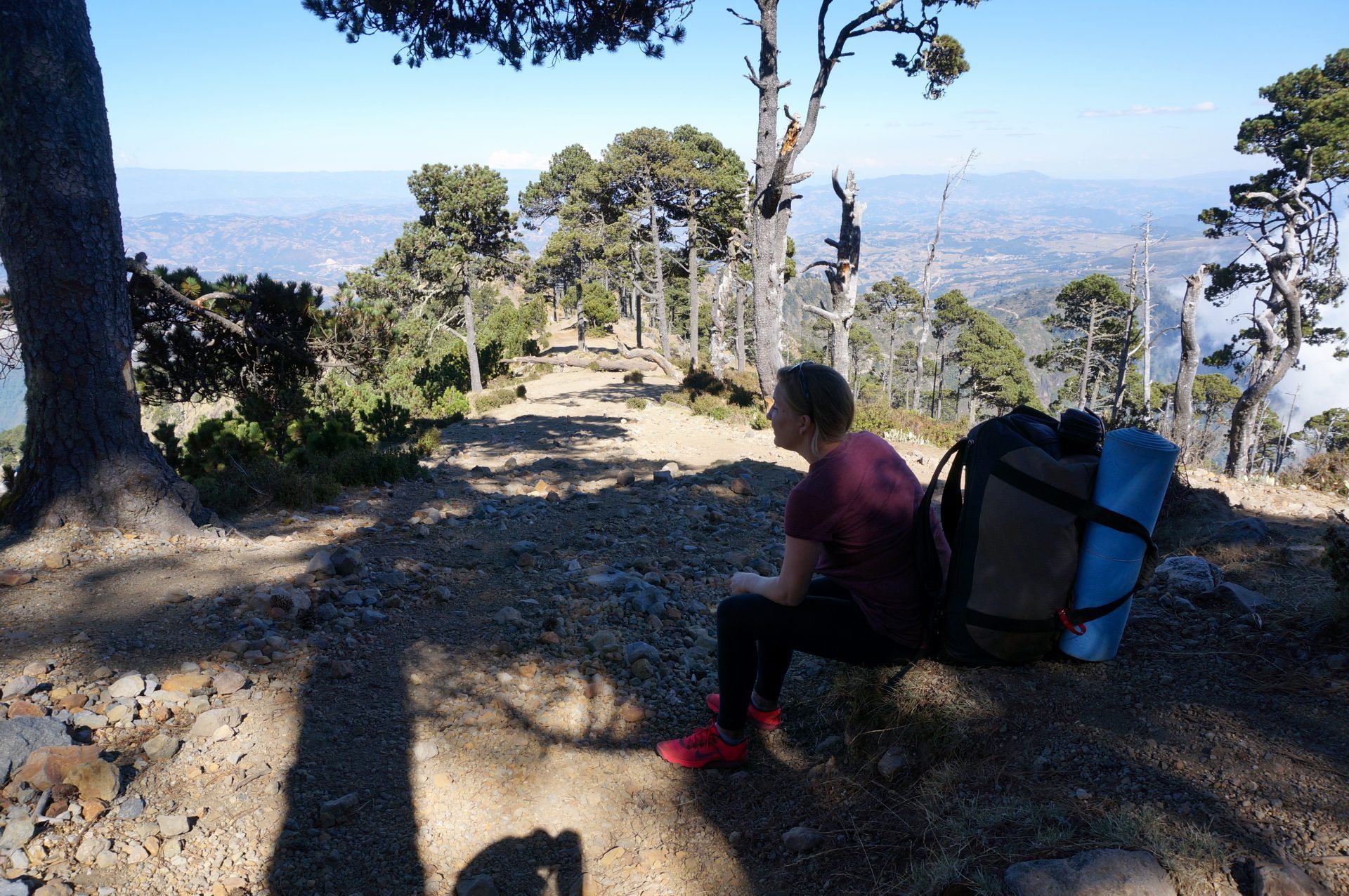
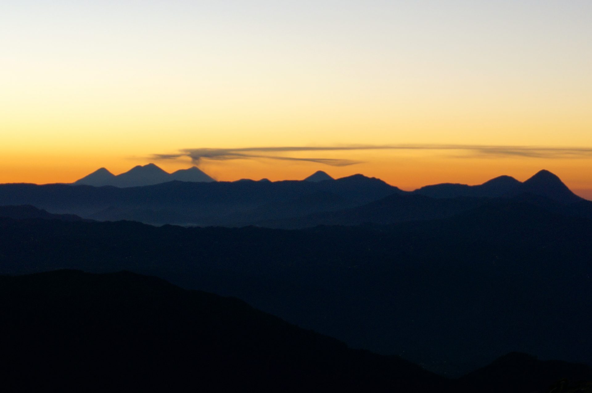
Tajumulco peak taken from camp just under the summit.
So how did we get here? We were staying in the nearby city of Xela, Guatemala, so when we discovered that the highest mountain in Central America was a dormant volcano only a few hours drive away, it was a challenge staring us right in the face that we must attempt to conquer. We signed up with an outfitter who was providing a guide and the camping gear for the overnight trek to the summit.
Exactly How Tall is the Highest Mountain in Central America?
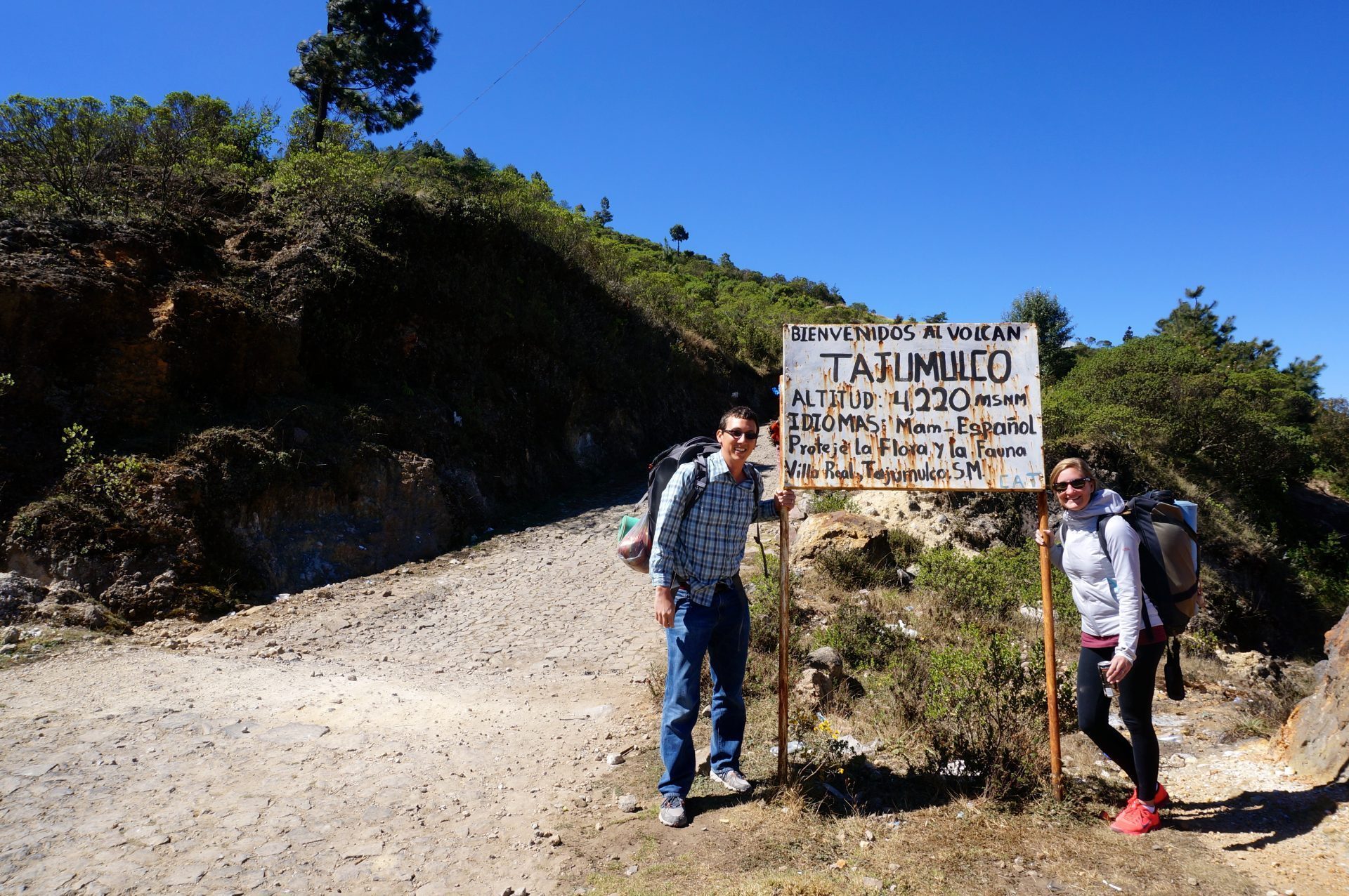
Tajumulco is the tallest mountain for “Central America.” But how high could it really be? We’ve hiked the Rockies before and surely Tajumulco has nothing on those huge peaks, right? Wrong. It’s actually taller than most all of the Rocky Mountains. At 4,220 meters in elevation, Tajumulco’s summit is more than 2.6 miles high. That’s taller than every US state’s highest point, except narrowly missing four (AK, WA, CO, & CA). Have you ever done the hike to Mount Mitchell (NC), the highest point in the entire Appalachian range? For perspective, Tajumulco is more than double its height. We had no idea.
Arriving to Volcan Tajumulco Guatemala
After packing our gear, we left around 6:00 AM, early on a Saturday morning to take a series of chicken buses a few hours to the trailhead.
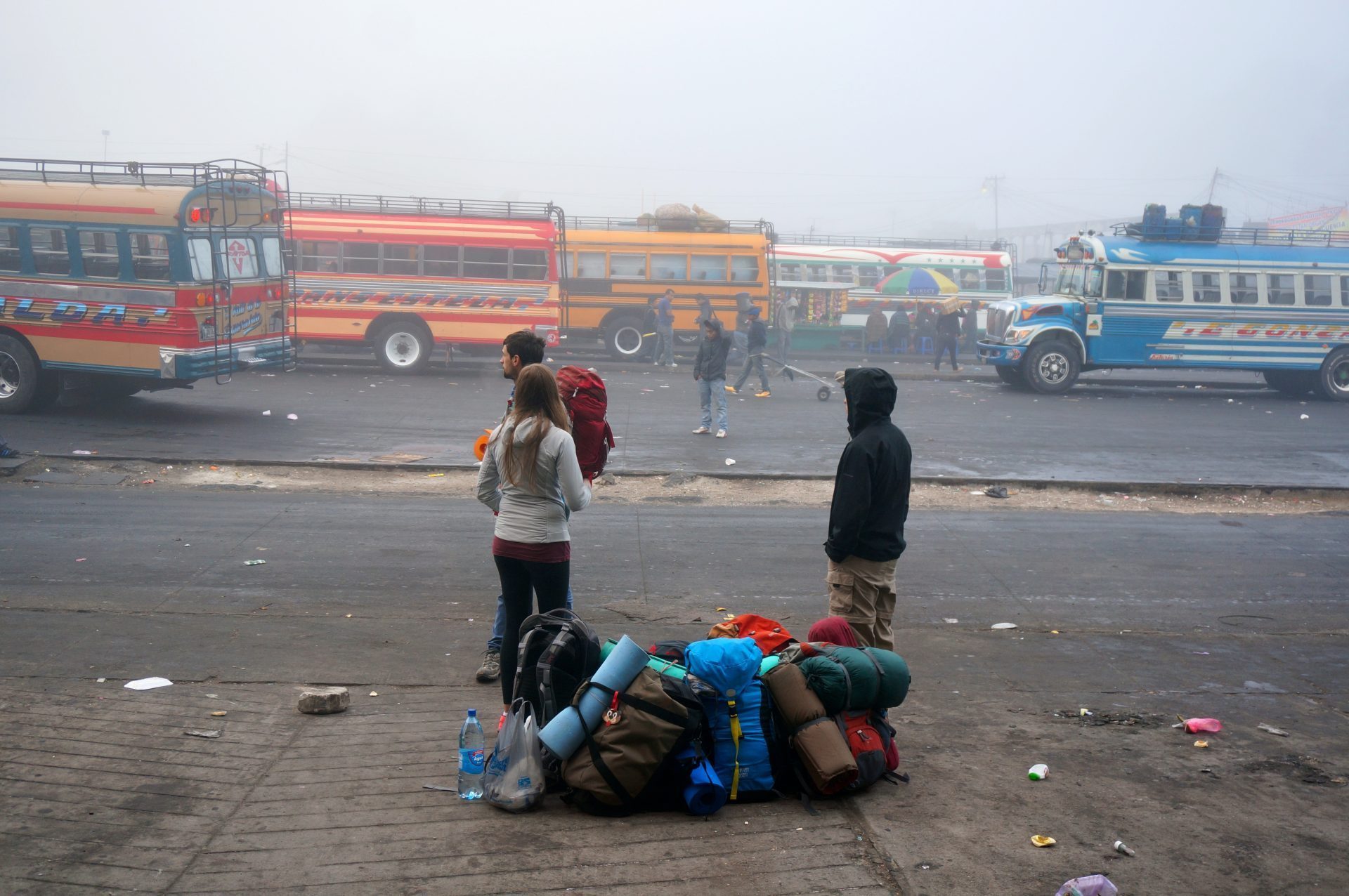
Joining us on the trek was our guide, his nine-year-old nephew (to help), and five other people who had signed up for the tour. The trailhead was a dusty dirt road. No single track or steep inclines. We could see Tajumulco from the trailhead and it looked so close that we were disappointed it wouldn’t be a longer and more challenging hike. The bus already took us up a decent length of the way. This would be smooth sailing from here.
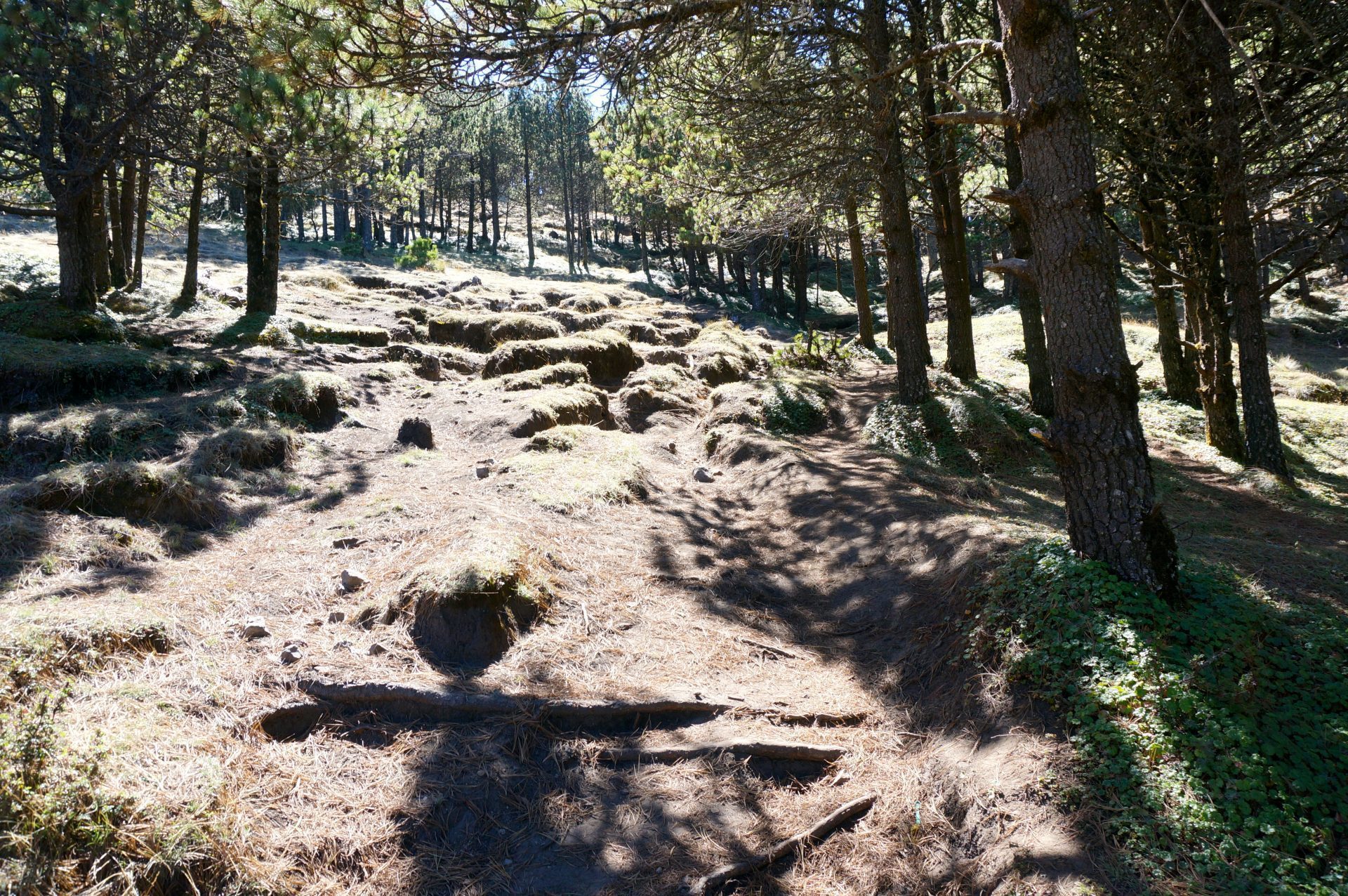
Beginning our Volcan Tajumulco Hike
The beginning of the trail was tame. Near the base there were a few Mayan people, their basic homes, and some boys herding sheep.

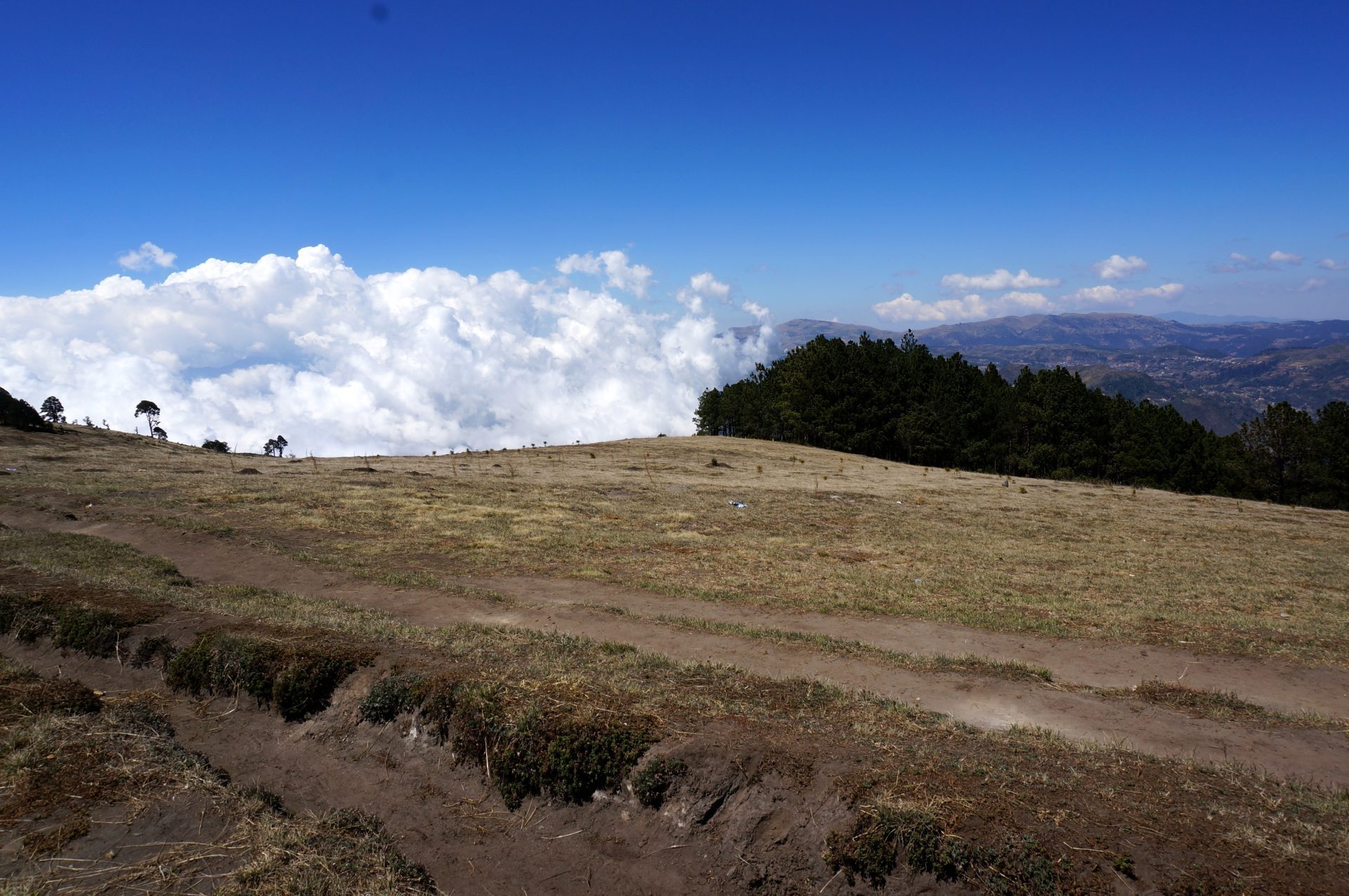
After about a half mile, any signs of civilization were gone. Then after about a mile, the trail began to narrow and the gradient became steeper and steeper. We began cutting through forests, across valleys, and along magnificent viewpoints. Clouds began to press up against the sides of the mountain and soon enough we were above the cloud line.
The trail was becoming more technical at times, with areas where we would have to hoist ourselves up over boulders and rock outcroppings.

Hiking Volcan Tajumulco: Slowing Down
Pretty soon we were lagging behind the rest of the group a bit. We’ve never had a difficult time hiking or keeping up with the pack. Usually we were the ones out ahead waiting for everyone else. What was going on here? It was total role reversal. Maybe we’ve gotten a little bit out of shape. Or perhaps the heavy packs we were carrying were weighing us down. As we chugged along, Maroon 5 was in my head because it was getting harder and harder to breathe.

Volcan Tajumulco Hike: Altitude Sickness
We had been at or near sea level for most of our trip so far. Just days earlier we were at the ocean and here we were now over 2 miles up in the air attempting to summit this peak. The others in our group had been in the highlands for weeks, some for months, and had acclimated to the altitude. We had not. No one had warned us about this, but we were really feeling the symptoms of altitude sickness. As we continued onward hiking Volcan Tajumulco more and more space grew between us and the rest of the group. Eventually the guide took the other five people onward and the nine-year-old nephew hung back with us. It wasn’t long when we reached a point in which we could only walk about five steps before needing to stop for a minute or two. We simply could not catch our breath in this extremely thin air. It is how I imagine asthma feels like. It was horrible.
But it wasn’t just the inability to breath. There was also the splitting migraine headache, the stomach sickness, the ringing in our ears, and the tingling throughout our bodies. It was awful. We were suffering from very bad altitude sickness. The nine-year-old boy was throwing up too. Well, I guess we weren’t the only ones feeling it. Walk five steps. Rest for a few minutes. Repeat. This is the game we played for the next several hours as we tried to get to where we were breaking camp. Everything was in slow motion as if we were walking through mud.
Volcan Tajumulco Camping
Finally we reached camp, at about 4,000 meters in height. Day 1 of our Volcan Tajumulco hike was over. After resting for a few minutes I decided to help gather some firewood since I wasn’t around to chip in with setting up camp. Even simply walking around on flat ground with no pack was proving extremely challenging up here. This was not normal. The Tylenol nor Advil could do a thing for our pounding skulls.

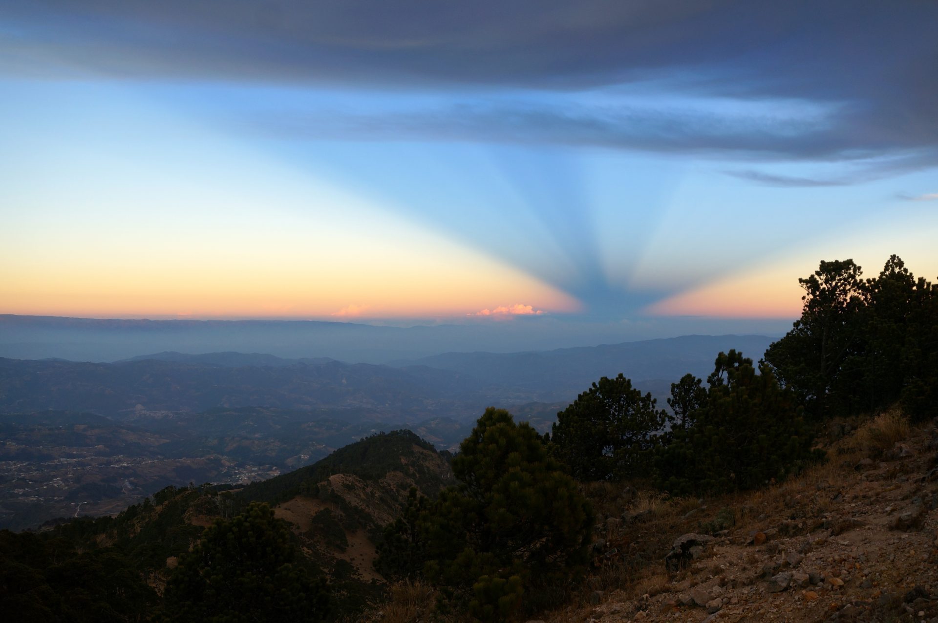
Rather unceremoniously, the sun set behind a mountain and some clouds. But it was minutes later in the East sky where strange inverted pyramid-shaped rays of slight glistened through.
It was already very cold up here, but now that the sun was down, it was downright freezing. We had figured Central America was all sunshine and coconuts. We thought we parted with our cold weather clothing when we left Michigan’s polar vortex. But we weren’t getting off that easy. We didn’t know this at the time, but temperatures would be plunging below freezing within the next few hours high atop this mountain.
Before we sought out on the trek, the outfitter noticed I had no jacket and he let me borrow one of his. It was pretty thin but I was so thankful to have it. I had a few shirts with me and I layered on every single one. I wrapped those few layers up with a rain poncho, not because it was raining, but because it was just one more thin layer to add. The multiple layers didn’t seem to do much though, since none were thick or warm. The shivering continued.
Our guide used his propane stove to cook us a delicious spaghetti dinner. Maybe I was just cold and hungry, but the homemade sauce using fresh tomatoes tasted as if it came from an Italian chef. The warm meal disappeared quickly into our bellies. A friendly dog had followed us all the way up from the trailhead, so it only felt right to share a little with him too.
The guide and fellow trekkers attempted to light a fire but it was just not catching. We both huddled around it, poking it, adding more wood, and fanning it with air in hopes of it catching to provide us some warmth. Occasionally we’d have a few minutes of fire but it just wouldn’t stay on strong. It was only about 8:00 at night but we decided to call it a night and perhaps try to warm up in our sleeping bags.
Among the nine of us, there were only three small two-person tents. The guide and his nephew (2 people) took one tent, a couple and a solo trekker (3) squeezed into another, and another couple (2) had the last tent. Um, so where is our tent? We could either split up for the night (one of us sleeps in the guide tent and while the other share a tent with the couple) or we could stay together and attempt to really squeeze in with the other couple, lying four-deep. We cliqued well with the couple so decided to pack into their tent. Cramming in the tiny tent together with this couple we had just met was only slightly awkward but was extremely tight-squeezed.
There would be no sleeping. First it was just shivering. Although we were sleeping with all our layers on, the subfreezing temps were still unbearable. But after a few hours our combined body heat and sleeping bags did their jobs and the shivering subsided. But the migraine headaches and other altitude symptoms were going full force. The cold hard ground and the sardine-packed conditions were not making matters better. Our heads resting on water bottles and whatever supplies remained in our backpack did not make for comfortable pillows. To describe it as uncomfortable is an extreme understatement. Finally around 1:00 am or so, we somehow nodded off for a few hours of broken sleep.
When we awoke around 4:00 in the morning, our tent mates were missing. Even their sleeping bags were gone. We eventually spotted them several feet away sleeping under the stars. They left the tent because they said (and I quote) “it was like sleeping next to a bunch of drunken walruses.” Apparently we were both snoring so loudly that they preferred to be out in the freezing elements. We felt really bad. We had a miserable night sleep ourselves and it seems their night was even worse, due to us.
Summiting Volcan Tajumulco
But we tried to get ourselves together to make the final hike to the summit in the pitch black dark, sick as hell, and on very little sleep. The frost on the ground and in the air had confirmed the freezing temperatures. The other five went at a normal steady pace, as we once again lagged behind trying to catch our breath. The hike-rest-hike routine was back in full force. Soon the glow of their flashlights disappeared up and around the side of the peak and we were again left with the nine-year-old to watch over us.
We were out from the forest and the rocky trail was like a moonscape. It became very steep, at times forcing us to climb in the dark, as loose rocks and gravel broke way and bounced down the cliffs below us until we could no longer hear it. The drop was straight down. This left us questioning if we somehow took a wrong turn in the dark. This couldn’t possibly be the trail. But we put our trust with the nine-year-old and proceeded onward and upward until we found ourselves hanging off the side of the mountain face, shining our lights at the darkness below, breathless and struck with fear.
False Summit
We’d been hiking for about two hours now, so surely we had to be close. Thankfully the faint dawn light began to creep in and slowly illuminate the sky. We could now see the way to go and it appeared that we were very close to the top. The only problem was that there didn’t seem to be anyone else up there. We were puzzled but continued. That’s when we heard a faint shout to our left. It was our guide on a neighboring peak. We were apparently summiting the wrong peak! Ahhh! So we spent the next 15 minutes climbing down a different face of the mountain, which connected the two peaks, before continuing with the ascent of the true summit. It wasn’t too much further and we now were reunited with our guide.
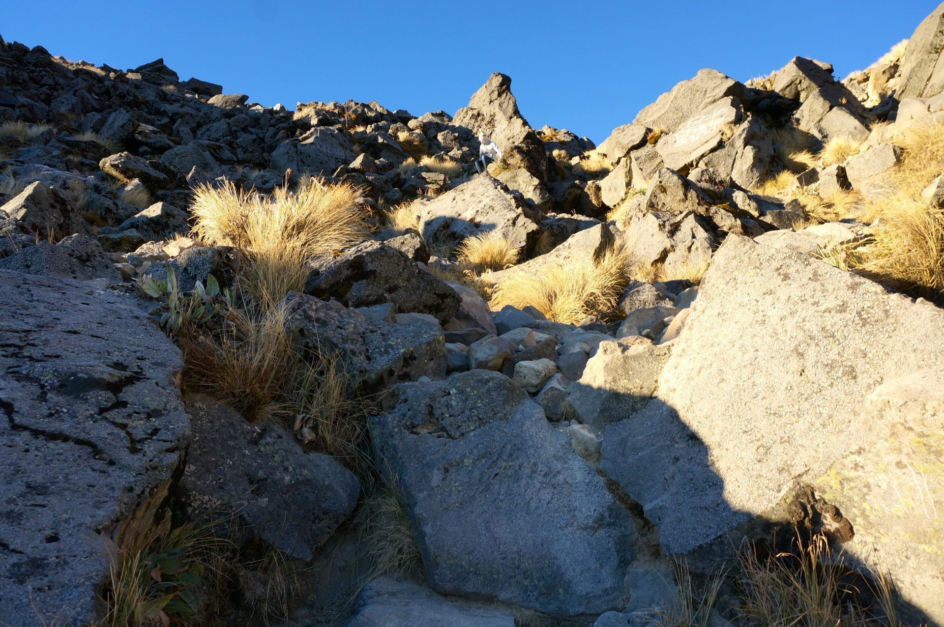
Not just a bunch of rocks. This is the correct trail to the summit.
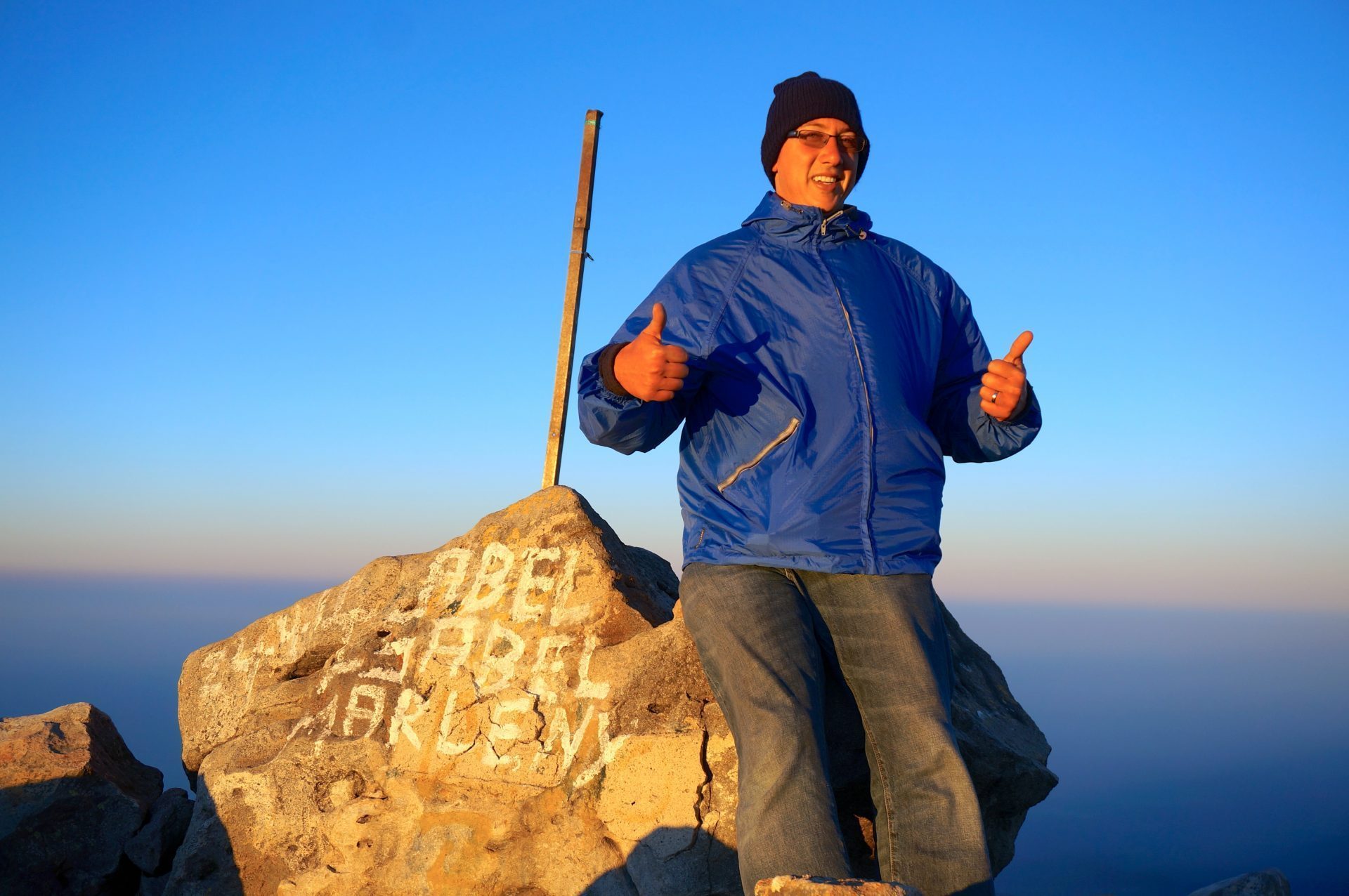
The True Summit of Tajumulco
The final summit was challenging (mostly just due to the altitude) but it was nothing compared to the impromptu mountain climbing we did on the neighboring peak in the dark. But, with everything against us, we finally reached the actual summit of Tajumulco! Hooray!
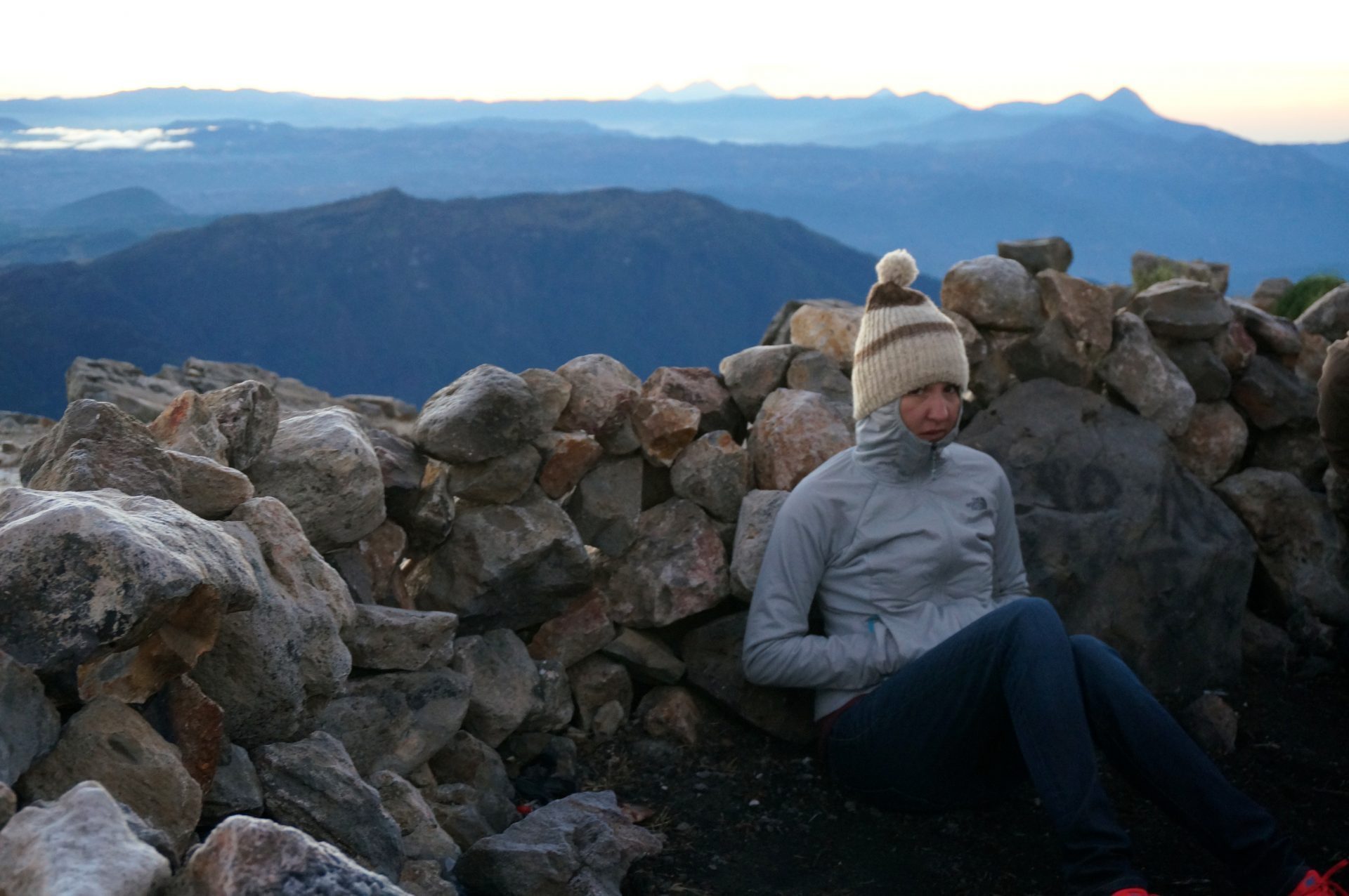
We got there just before the sun was going to reveal itself over the volcanoes and mountains to our East. The summit was very cold and windy, yet for a brief moment the joy of accomplishment had subdued the fatigue, misery, and altitude sickness.
Well, perhaps Heather was still not feeling very well.
Ok, now lets put aside the pain and agony and look happy for a victory photo!
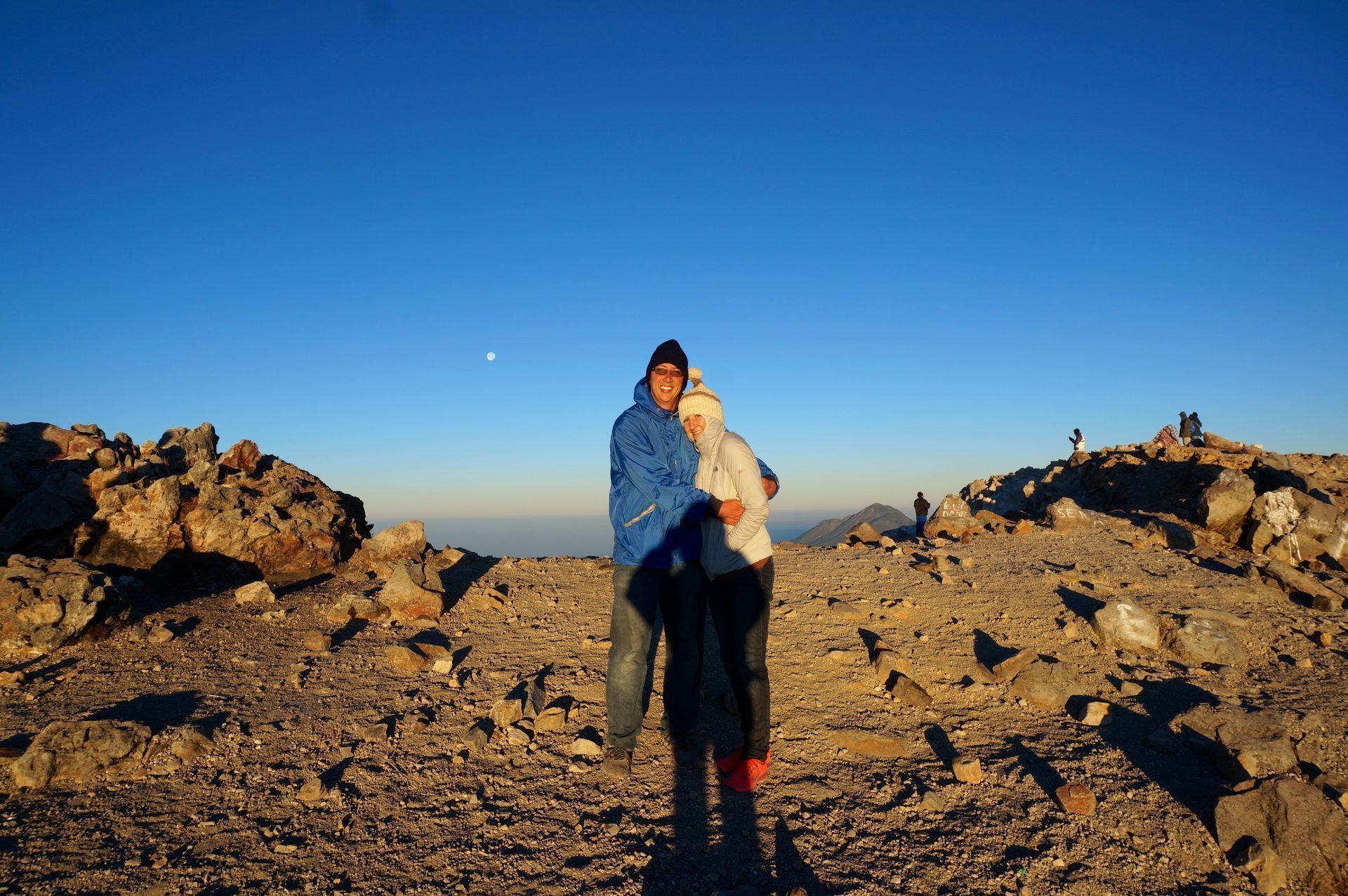
We were on top of the world! Or at least on top of Central America! You could see all the way into Mexico and the fog rising over the Pacific Ocean. The views were incredible and pictures can’t even begin to do it justice. After the sunrise, an enormous shadow was cast out from the volcano we were on top of, which was a very interesting site.

Struggling Down Volcan Tajumulco
We enjoyed the sunrise and spectacular views for about an hour before reversing our Volcan Tajumulco hike to make our way back down to lower altitudes. It was thankfully only downhill from here (or so we thought) and going down the correct trail was much easier than the way we ascended. Since we were still moving at a slower pace, we again hiked under the guidance of the not-so-trusty nine-year-old. The trail back down to camp should only take about an hour. Sure, we were slow, but at two hours something just didn’t seem right. Then we began to notice areas we had passed well before reaching camp the day prior. We somehow had hiked down about an hour further passed camp, which now required us to hike all the way back up to camp.
The boy had got us lost …again! For those of you keeping track, this is now twice in the same morning! He was only nine, so it was hard to be mad at him, but our patience was running very thin at this point. With the altitude sickness still greatly hindering us, it took everything we had to hike up all the extra distance back to camp. This entire bonus hike, added a few more hours to our already very strenuous morning. Once finally reaching camp, everyone was worried and thought we had gotten hurt. The guide had even gone back up towards the summit looking for us.
A Trustworthy Dog on Tajumulco
After regrouping, finally eating breakfast, and getting packed, it was time to descend back down. We didn’t want to slow the group one final time, so the two of us decided to leave shortly before the rest, as they would certainly catch up. We knew the way because we had just hiked down there when the boy overshot camp. No guide needed. But the friendly dog we had shared our dinner with decided to tag along. There were some forks in the trail but we just followed the dog. It turns out the dog was a better guide than the boy. We should have just enlisted his services.
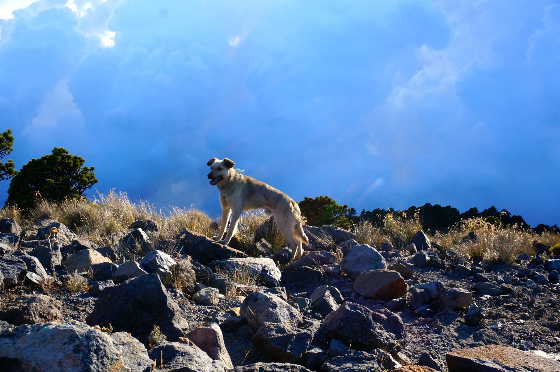
As we got lower and lower we could feel ourselves returning to normal. The migraine turned into a mild headache. Stomach sickness subsided. The tingling stopped altogether. This really motivated me to go faster down the mountain as I could feel myself getting better with each step.
The rest of the group did catch up with us but the dog got us the entire way back down to the trailhead. That’s a good boy!

Despite the altitude sickness, extreme freezing temps, less-than-ideal sleeping conditions, and getting lost (twice!), we’re glad to have conquered this once-in-a-lifetime summit. It was certainly an experience and much more difficult than we ever imagined. But it was a remarkable achievement to have summited the tallest mountain in all of Central America. The challenge of Tajumulco was deceptive but we overcame the trials it lobbed at us and truly enjoyed the rewards the summit offered.
Lessons Learned Hiking Tajumulco Guatemala
Lessons learned:
- (1) wait to acclimate to the altitude,
- (2) bring very warm clothes, and
- (3) always trust a friendly dog.
THAT LOOKS THAT YOU GUYS HAD A VERY NICE ADVENTURE THERE, I CLIMED UP THE TAJUMULCO VOLCANO ALSO AND I KNOW IS TIRING BUT AT THE SAME TIME ENJOYABLE, I SUGGEST TAKING WARM CLOTHS GOING TRAILHEAD, I LIKE THE STORY YOU WROTE ABOUT THE DOG SALUDOS YO SOY DE GUATEMALA, GOD BLESS YOU GUYS KEEP KEEP UP WITH YOUR GOOD ATTITUDE IN VISITTING AMAZING NATURE PLACES …… 🙂
Thanks and so glad to hear you also had a positive experience on Tajumulco!
I just did this hike alone, yesterday, and without a guide. (Not highly recommended as a single female, but I live dangerously). It is definitely a hard hike, despite what the distances say. I set my GPS on the way down (well, when I got back to base camp) and it was almost 5.25 miles back down to the chicken bus stop. Add the extra 100m to the summit and that’s a more accurate distance. So about 11 miles round trip.
Beautiful hike!!! The views are stunning! Be careful if a storm rolls in. Start EARLY if you are going alone and without a guide. I did it as a day hike.
Wow, you’re a rockstar! That is awesome you managed to do the hike by yourself! Agree with you not recommending it for solo hikers to attempt, but still pretty awesome that you managed the feat. The hike definitely seemed more difficult than the distances suggest. Seemed way longer than 5.5 miles each way but I know that is about the accurate length and glad to hear your GPS confirming it.
Thanks for leaving this advice for anyone else attempting the summit!
Hey there- sounded really interesting, I’m going this August and was wondering what guide service you used? It seems like you had a good experience and I’m trying to find something similar. Thanks!
We used Quetzaltrekkers. Overall they were pretty good and we’d recommend. But do check on the tent configuration before leaving for the trek. There were 4 of us that were put into a 2-3 person tent which was extremely tight quarters to sleep in.
Wow. It must have been an awesome adventure but a very difficult achievement indeed.
My girlfriend and I were invited to climb the volcano next week on Friday… We live in Guatemala City, I’m 29 and I just quit smoking two weeks ago.
I wanted to conquer something great on my first 21 days of not smoking but after reading this… It sounds impossible and scary…
Maybe in a not so distant future we’ll climb it.
Hi Andy, We had a tough time trekking Tajumulco mainly do to the altitude. If you’re living in Guatemala City, you’re already acclimatized to about 5,000 feet high, so you likely wouldn’t feel the harsh affects like we did. Everyone else in our group had been acclimatized and didn’t seem to have any trouble at all when sticking with the guide. If you are in reasonably good shape and are able to hike 10 miles or so, I would say give this summit a try! 🙂 Don’t let our harrowing tale stop you from going. PS. Congrats on the accomplishment of quitting smoking!
I love this honest report 😀 I’m kinda glad I+m not the only one struggling. I did a trail in Turkey totally fell in love with hiking, even though I have a few health problems that are not the best for hiking 😀 This winter I hope to get to central america and hike in every country if possible…so tell me…is the guide necesery, are there any markers on the trail cause I wish to do it alone
l
love peace and pancakes from croatia
pam
There are no markers on the trail but the first part of the trail to the camp is pretty straight forward. There really isn’t any major forks in the trail. But I would not recommend hiking from camp to the top in the dark on your own. We did that with a guide (sort of) and still wound up on the wrong peak. If you were to do it all in the daylight, I think it may be possible to do on your own. But I’d probably recommend guide service. It was cheap, nice to not have to worry about whether we were going the right way, made some friends, and had our meals covered.
Cool hike. Nice photos I’m climbing Tajumulco a month from now, to bag another country’s high point. I’m a little disappointed to learn on another site that the main trail is only 6km long. True? Also – I was wondering about doing it without a guide. Did you encounter anyone doing that? The internet is pretty sparse on details.
Thanks … and have fun in Turkyie. I went to Cappadocia myself and found it to be a little too expensive. I set out on a trek alone in the hills north of Urgup and had a great time.
If you’re going to western China eventually, send me an email. I lived there and it is truly one of the world’s finest destinations. (Also I’d love to hear your advice on Tajumulco)
I don’t recall the distance. It certainly seemed like more than 6km though. It took us about 4-5 hours to the camp just below the summit and another 45 minutes or so from there. Granted we were really suffering from the altitude and perhaps a little out of shape at the time, but it really seemed longer than 6km. I’d think at least 10, but thats just going off memory, so take that for what it is.
If you have all of your gear, I think it can be done without a guide. While its not marked very well, it is a pretty easy-to-follow trail. I wouldn’t recommend doing the summit in the dark though without a guide because that portion of the trail was a little difficult to follow in the dark. But I’d imagine its easier in the daylight hours. Some people do the entire trek up and down in the same day. So if you’re an avid hiker, you might want to consider that too. It’ll be a long day, but very possible, plus you won’t have to haul up all your gear. We did see a couple people doing that without a guide. Didn’t see any overnight trekkers without a guide.
Thanks for the recommendations of Turkey and China. We’re going to try to head out to China eventually but not anytime soon. Safe travels and have fun ticking Tajumulco off your highest-point list!
I truly enjoyed reading about your adventure. The dog added a cute touch to the story. I can relate this to when we went hiking in California. Of course, got lost, and froze overnight, but probably not as cold as you all got. Keep the stories coming, well written. Love, mom.