After exploring the cenotes of Cuzuma on a horse-pulled mining cart, we were off to the small Mayan village of Santa Elena approximately a two-hour drive away. We wanted to visit the Mayan ruins of Uxmal the following day and Santa Elena was a short 15-minute drive from there. On a map, the two-hour route from Cuzama to Santa Elena seemed pretty easy to follow. But actually trying to drive and navigate it was anything but easy.
First of all, the poorly maintained dirt roads we were taking were laden with potholes that I would more accurately call “pot-craters.” Some were several feet deep and spanned nearly the entire road. It was a painfully slow drive in order to get around them.
Just when you’d get to a good stretch in the road with a nice cruising speed of 40 MPH or so – “wham!” Throughout the entire drive I was swerving back and forth to across the road to miss these pot-craters, but many are simply unavoidable. Throw some rolling hills into the mix and this was becoming a roller coaster ride that I had limited control of. I am absolutely amazed how we didn’t blow a tire. In retrospect I wish I had checked to see what brand of tires they used because if they could endure these roads without a flat, they can endure anything. I want these miracle tires on every car I own for the rest of my life.
While on these rough back roads, we often wouldn’t see any other cars for miles. We would soon grow worried that we were even on the right road. GPS on our phones weren’t working, leaving us to check our keychain compass to at least make sure we were traveling in the right direction.
After about 30 minutes or so we finally reached a small village, unmarked on our detailed map we had seen. No signs whatsoever to tell you what this village is. This would be the first of dozens of villages that we would encounter along our 5-day Yucatan road trip, and they were all a very similar experience to go through.
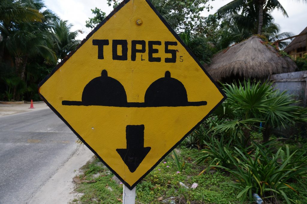
It all starts with about 30 sets of “topes.” Topes is the word that is used for speed bumps, but these topes are much taller, steeper, and speed-bumpier than any I’ve encountered in the States. To go over topes you must crawl to about a single mile per hour to avoid taking a bumper off.
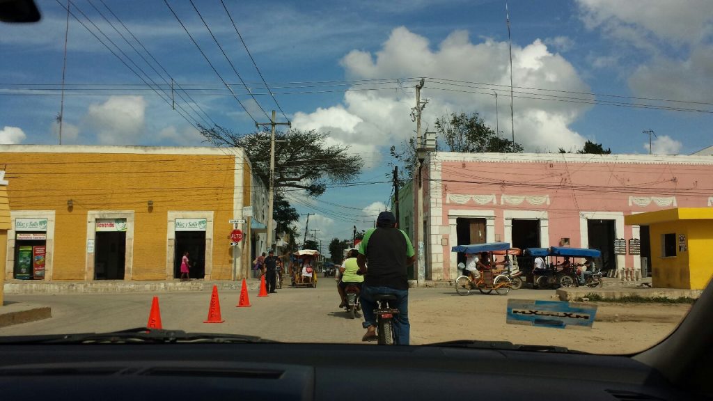
Once you’ve navigated through the speed bump obstacle course, you reach a dizzying frenzy of villagers on bicycles, mopeds, motorcycles, and tuk-tuks. All are weaving in and out from in front, behind, and to the side of you and some carrying double-barrel shotguns on their backs. Children are also playing in the streets and frantically running around all over the place.
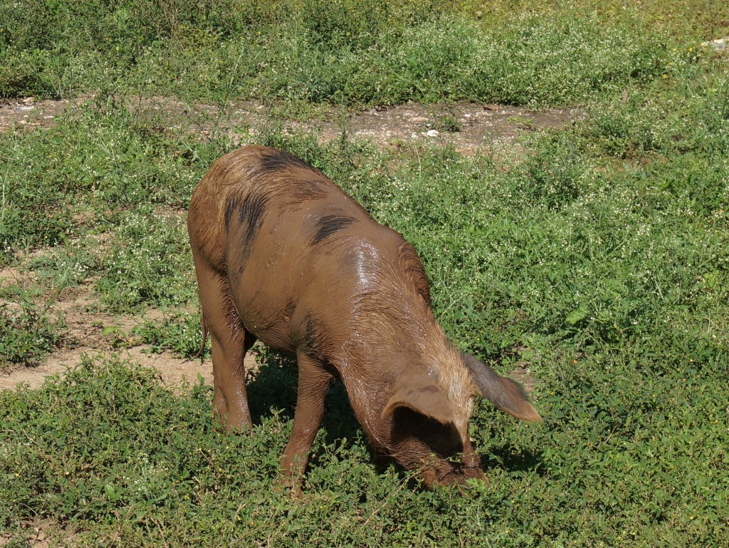
Several dogs bolt around too while others prefer to lay right smack in the middle of the road like they own it. Then there’s the livestock. As if the dogs weren’t enough, there are chickens, turkeys, sheep, and pigs. None are penned in nor tied up anywhere. It makes you wonder how they keep track of them without wondering off. Meanwhile its reassuring that villagers seem to have no concern that someone is going to steal their turkey.
The village usually has cross streets and forks in the road, some splintering into five or more directions. At these points we’ll say a prayer to the Mayan Gods and hopefully choose the correct path.
Sometimes at these crazy intersections there are stop signs (well, “Alto” signs here). But we started calling them “suggestion signs” instead of stop signs because no one seemed to pay any attention to them ever.
Speed limits also seemed to be suggestions. At some points there would be one speed limit painted on the road while a speed limit sign next to it would indicate a completely different speed. Cops were usually present only in the villages and didn’t really seem interested in catching people for minor traffic violations or speed traps as they do in the US, which was refreshing.
Speaking of cops, one peculiarity is that they always have their police lights on. I first discovered this while seeing the blue in red lights in our rear view mirror getting closer and closer. I panicked a little as I thought I was being pulled over. Nope, that’s just how they roll. I’m a little unclear about how to tell if you are actually being pulled over since their police lights seem to be permanently on.
In these villages you’ll randomly roll into, there’s always a disproportionately large church relative to the size of the small town, a nice village square area, and a playground. The dusty road will diverge into a one-way and twist and turn in every direction through the village. You may even somehow make a circle. Then there’s a market, a construction project, or parked truck blocking the way. This will inevitably divert you onto some other road. Any sense of direction you once had, is now gone.
Now that you’re completely turned around, you’ll find numerous cross streets heading every which way out of the village. No directional signs, EVER.
The only way we could figure out the correct way would be to pick out the jolliest looking man or woman who happened to be hanging out on the side of the road. I would proceed to stick my gringo head out the window and ask with possibly the slowest, most American-sounding accent possible “Donde es-ta el camino a [next village on our route].” (Translation: “Where is the road to [village]”).
Now I’ll pat myself on the back for having learned enough Spanish to ask this question. But it didn’t matter much because I couldn’t understand a lick of the response we were given. We would watch very carefully for hand gestures and pointing which would usually give us something to work off of in order to make an educated guess. These villagers providing directions tended to be very friendly about it and would really try to explain detailed directions. We appreciated their efforts, as somehow we would manage to pick the right road.
Three hours into a supposed hour-long journey, we reached our destination of Santa Elena. Over the next several days we would repeat the same experience on each leg of our Yucatan road trip. Thankfully the roads on the Ruta Puuc were smoother.
I must say though that there are some very well maintained roads and highways in Mexico too, but they do not always go exactly where you’re trying to go. If ever driving around the Yucatan, I’d highly suggest seeking out and using these main thoroughfares as much as you can. Even if it seems to make your trip much longer – trust me – just use them. We found out the hard way that what is clearly a shortcut on a map, is actually a much more time consuming headache than the lengthier-in-distance highway routes. And while Google Maps tends to work quite nicely in the States, it just tells a bunch of lies in the Mexican countryside.
Several days of potholes and topes had damaged the car so that the undercarriage of the front bumper was hanging off and scraping the road. Whenever going over any topes at all something would fall off. Every time as we’d hear that awful scraping sound, I’d fear the entire undercarriage would come off completely.
Thankfully it never did but now I was still concerned about what the rental car agency would think when they noticed it. They had a hold on our credit card and I had signed much paper work about covering damages. I turned in the car. No one noticed. The hold was released. The paper work was handed back. We walked away quickly. …very quickly. Phew!
Perhaps from here out, we’ll leave the driving to the professionals. Indeed, bus it is.


My beau and I are planning a very similar trip to the Yucatan. All of your Mexico posts helped us firm up plans in deciding just where to go while there. We will be renting a car and I was hoping you could give us some recs for good maps. Maps for driving, maps for cities, cenotes and jungle hikes as well. We are striving to do as much if this DIY/self guided as possible.
Thanks for the feedback and glad to hear you found the Mexico posts helpful! We used GPS and online maps. We use a smartphone with t-mobile that comes with a free international data plan that proved very useful in Mexico. It didn’t work on the remote backroads, but received signal nearly everywhere else. We simply used Google Maps to help us get around and found it to be very accurate. The only thing I’d warn is to stick to the highways / main roads even if Google Maps suggests routes otherwise and it looks to be shorter. The highways are fast and super easy navigate compared to the crazy dirt roads that lack signage and can be in bad condition. Hope that helps!
Sounds like quite the interesting drive! I will be driving in the Yucatan when I visit this fall. Do you know if the highways are good from Merida to Santa Elena?
Thanks!
Brittany
Yes, its a pretty straight shot and the highway there is fine. Our backroad route was completely different way to go. Had we do it again, I’d definitely take the highways which is exactly what we did on our return to Merida.
Interesting. Sounds like your driving skills were put to the test!